Nicaragua Rainforests: 5 Wild Forests, Wildlife and Where to Stay

From the vast Bosawás landscape to the misty slopes of Mombacho and Volcán Maderas, discover five distinct rainforest experiences in Nicaragua, where to stay nearby, what wildlife lives there, and what families should know before visiting.
Nicaragua’s green spaces are far more varied than a single rainforest on a map. In the northeast, the enormous Bosawás Biosphere Reserve protects a mosaic of tropical forests and Indigenous homelands. In the southeast, Indio Maíz connects humid forest, rivers, wetlands, and coastal ecosystems. Around the Pacific highlands, Mombacho, Miraflor, and Volcán Maderas replace lowland heat with mist, epiphytes, crater landscapes, farms, and cloud forest.
That variety is exactly what makes rainforest travel in Nicaragua so rewarding, but it also means families need to choose carefully. Some places work as accessible day trips. Others require boats, rural roads, guides, or a full travel day. A lodge near a reserve is not necessarily inside its protected core, and a landscape that supports jaguars or tapirs does not make either animal a likely sighting.
This guide compares five of Nicaragua’s most distinctive rainforest and cloud-forest experiences. It explains where each one is, what makes it special, where to stay nearby, what wildlife the wider habitat supports, and how the layers of a tropical rainforest fit together.
What is a rainforest? Understanding the four layers
A rainforest is not divided into four sealed floors. The layers overlap through branches, vines, roots, treefall gaps, and changing light. Ecologists still use four broad names because they make the forest’s vertical structure easier to understand.(Smithsonian rainforest layers guide)
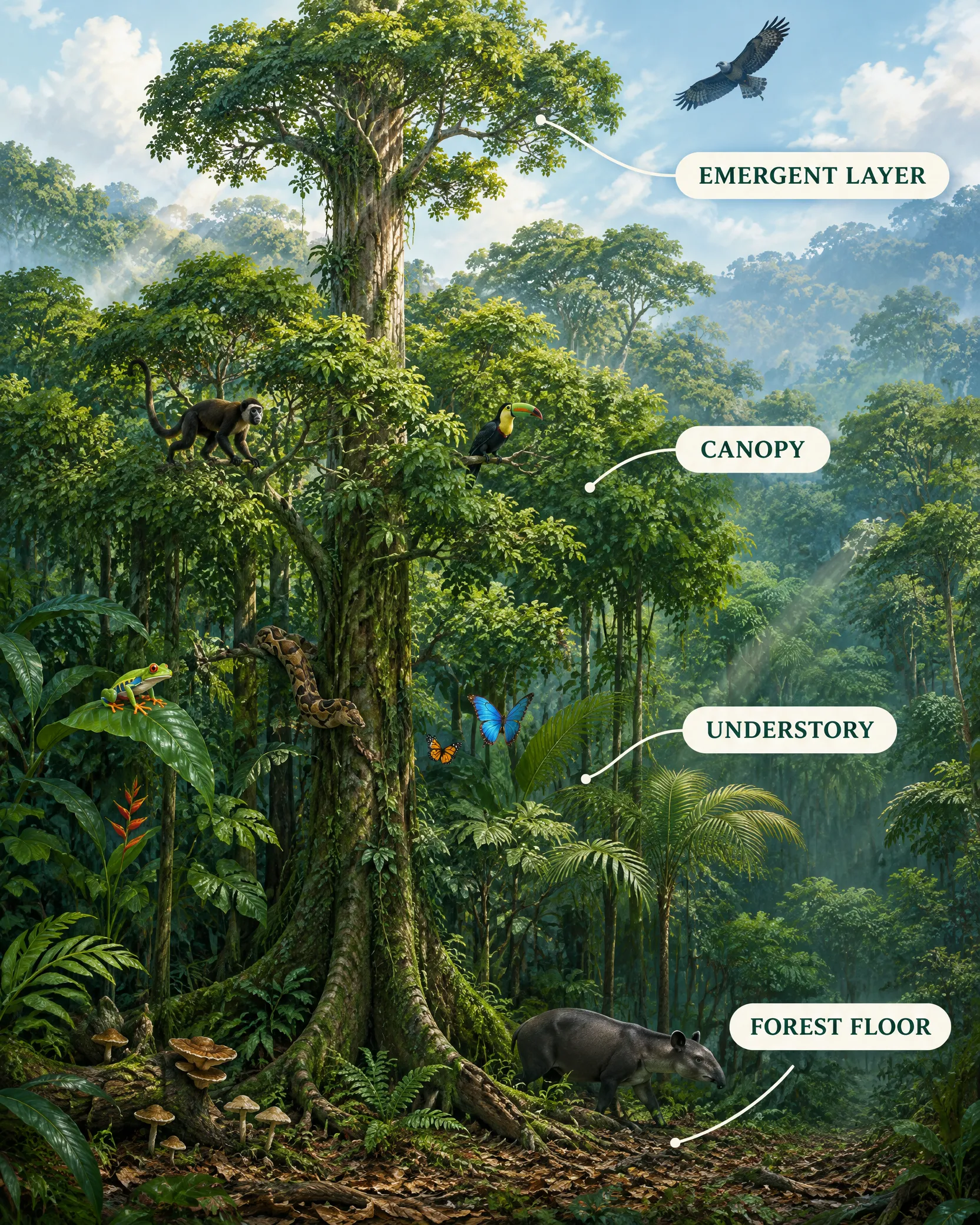
Original illustration created for Our Life Adventures. The structure is informed by Smithsonian Tropical Research Institute rainforest ecology resources.(Smithsonian rainforest layers guide; Smithsonian canopy guide; Smithsonian understory guide) (Smithsonian forest-floor guide) Animals are representative habitat cues, not a wildlife-sighting guide.
| Layer | What defines it | What the illustration shows |
|---|---|---|
| Emergent layer | A few of the tallest crowns rise above the main forest roof, exposed to stronger sun, wind, and weather. | A towering crown and a distant large raptor silhouette above the main canopy. |
| Canopy | Interlocking crowns form a partly permeable roof that catches much of the light and rain while leaving gaps for regeneration. | Connected branches, a monkey, a toucan, and dense foliage with uneven crown heights. |
| Understory | Young trees, palms, shrubs, broad leaves, and vines grow in dimmer, more humid conditions below the canopy. | A tree frog, boa, butterflies, palms, vines, and mottled light. |
| Forest floor | Leaf litter, fallen wood, fungi, decomposers, and roots recycle nutrients under filtered light. | Buttress roots, fungi, leaf litter, and a quiet Baird’s tapir silhouette. |
The animals in the diagram are teaching cues rather than strict layer assignments. Monkeys may move between canopy levels. Frogs depend on moisture and breeding habitat, not a single horizontal band. Tapirs range through ground-level forest and water-linked habitats, while a harpy eagle depends on extensive intact forest and should never be presented as a common visitor sighting.(Volcán Maderas epiphyte study; Smithsonian rainforest layers guide; Convention on Biological Diversity)
Nicaragua’s rainforest regions at a glance
| Rainforest region | Where it is | What makes it special | Suggested nearby stay | Best fit for families |
|---|---|---|---|---|
| Bosawás via Peñas Blancas | Jinotega and northeastern Nicaragua | A cloud-forest gateway into a vast UNESCO biosphere landscape | Reserva Los Nogales | Nature-curious families comfortable with a rural travel day |
| Indio Maíz and Río San Juan | Southeastern Nicaragua | River-accessed humid forest linked to wetlands and the Mesoamerican Biological Corridor | Guácimo River Lodge | Prepared families who enjoy boats, remote settings, and flexible plans |
| Mombacho Volcano | Near Granada | Accessible cloud forest, crater geology, fumaroles, and epiphyte-rich slopes | Mombacho Lodge | Families seeking the easiest cloud-forest day trip from a major visitor base |
| Miraflor-Moropotente | Northeast of Estelí | A lived-in protected landscape of cloud forest, farms, oak-pine forest, and headwaters | Finca Neblina del Bosque | Families interested in guided walks, farm life, and slower rural travel |
| Volcán Maderas | Ometepe Island | Wet upper cloud forest, a crater lagoon, and a dramatic island elevation gradient | Selvista Guesthouses | Families who want a forested foothills base; summit hiking is for prepared older hikers |
1. Bosawás Biosphere Reserve, explored from Peñas Blancas
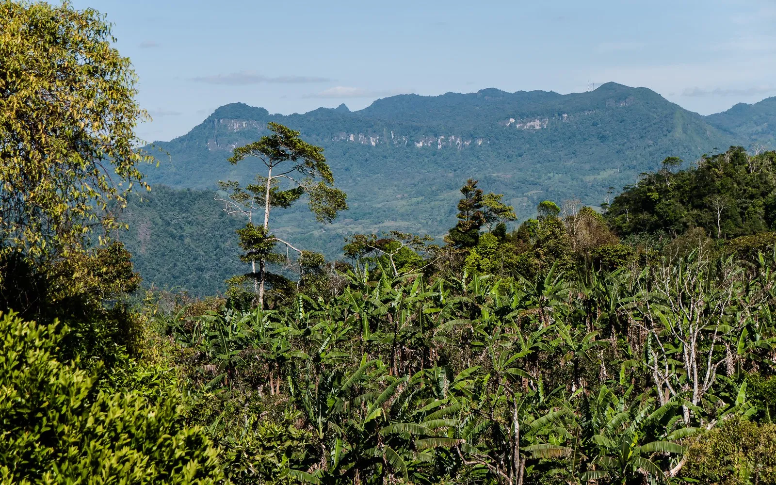
Location photograph: Peñas Blancas, Bosawás Biosphere Reserve, by Rebecca Ore, via Wikimedia Commons, CC BY-SA 3.0. Cropped for layout.(Wikimedia Commons: Peñas Blancas)

Where it is
Bosawás lies in northeastern Nicaragua along the Honduran border. UNESCO designated it a Man and the Biosphere Reserve in 1997 and currently describes a landscape of nearly two million hectares with six forest types, high biodiversity, and Indigenous and local communities.(UNESCO Bosawás profile) It is important to use the correct designation: Bosawás is a UNESCO Biosphere Reserve, not an inscribed UNESCO World Heritage Site.
For most families, the realistic introduction is Macizo de Peñas Blancas in Jinotega, one of the protected areas that forms part of the wider Bosawás complex.(MARENA Jinotega monitoring) Peñas Blancas should be described as an accessible mountain and cloud-forest gateway, not as the remote Bosawás core.
What makes it special
The scale of the wider biosphere reserve is difficult to grasp. Bosawás protects connected tropical forest across mountains, lowlands, rivers, and community lands. Peñas Blancas offers a more approachable window into that landscape through cool forest, waterfalls, steep green ridges, birds, and rural farms.
Nicaragua’s environment ministry has documented wildlife signs and observations in the Peñas Blancas area, including ocelot and agouti tracks, keel-billed toucans, sloths, and forest birds. It also reported a resplendent quetzal observation in the buffer zone.(MARENA Jinotega monitoring; MARENA quetzal report; MARENA Peñas Blancas wildlife report) These records confirm habitat value, but they are not a list of animals visitors can expect to see.
Where to stay nearby
Reserva Los Nogales is the clearest family base for this section. Its official address places it in the Macizo de Peñas Blancas Natural Reserve, and the property lists cabins that can accommodate families.(Reserva Los Nogales) The lodge’s current directions involve travel through Matagalpa, onward public transport, and a final dirt-road approach. Families should treat the journey as a full travel day and confirm transport, meals, road conditions, and arrival time directly with the property.
Who it suits: patient, outdoors-oriented families who value a small rural base, guided nature experiences, and quiet forest time more than resort convenience.
2. Indio Maíz Biological Reserve and the Río San Juan
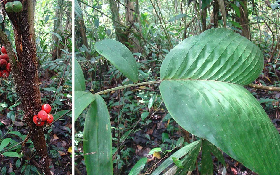
Location photograph: Bactris palm, known as Biscoyol, in Indio Maíz Biological Reserve, by Dick Culbert, via Wikimedia Commons, CC BY 2.0. Cropped for layout.(Wikimedia Commons: Indio Maíz)
.jpg)
Where it is
Indio Maíz lies in southeastern Nicaragua in the Río San Juan Department. It is one of seven protected areas within UNESCO’s Río San Juan Biosphere Reserve, a larger landscape that includes humid tropical forest, rivers, wetlands, tidal marshes, lagoons, and estuaries.(UNESCO Río San Juan profile)
The Wildlife Conservation Society places Indio Maíz within the connected Indio Maíz-Tortuguero forest landscape, which extends toward protected areas in Costa Rica. The region also overlaps Rama and Kriol territory and other settled buffer-zone communities, so it should be treated as a living conservation landscape rather than empty wilderness.(UNESCO Río San Juan profile; Wildlife Conservation Society)
What makes it special
Indio Maíz feels defined by water. Reaching the area usually means moving along the Río San Juan and approaching forest from a boat rather than a highway. The protected landscape links tall humid forest with swamps, mangroves, beaches, and lagoons, which makes it ecologically different from Nicaragua’s volcanic cloud forests.(Wildlife Conservation Society)
A peer-reviewed remote-sensing study describes Indio Maíz as remote and difficult to access.(peer-reviewed Indio Maíz study) Recent camera-trap work by Nicaragua’s environment ministry documented white-lipped peccaries, Central American agoutis, pumas, ocelots, and great curassows inside the reserve.(MARENA camera-trap report) Those records show that the forest supports sensitive wildlife. They do not turn a family visit into a guaranteed safari.
Where to stay nearby
Guácimo River Lodge is a practical water-access base near Indio Maíz. The lodge states that it sits in the biosphere reserve’s buffer zone, about one kilometre west of the biological reserve, with forest connected to the larger protected area through a corridor.(Guácimo Lodge access guide; Guácimo buffer-zone project; Guácimo Río San Juan travel guide) It should not be described as accommodation inside Indio Maíz Biological Reserve.
The current access information routes visitors through San Carlos and El Castillo, followed by a lodge boat transfer.(Guácimo Lodge access guide) Families should reconfirm boat times, weather, guides, activities, age guidance, and any reserve-entry arrangements before traveling.
Who it suits: adventurous families, especially those with older children, who are comfortable with boats, remote logistics, flexible schedules, and a nature-first stay.
3. Mombacho Volcano Natural Reserve near Granada
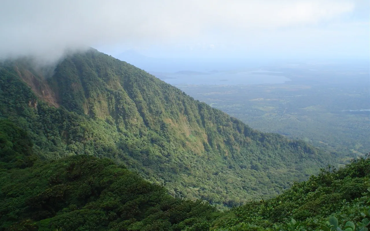
Location photograph: Mombacho Volcano, by KEITH, via Wikimedia Commons, CC BY-SA 3.0. Cropped for layout.(Wikimedia Commons: Mombacho)

Where it is
Mombacho rises beside Lake Nicaragua about 10 kilometres from Granada. Its protected upper slopes contain tropical cloud forest and a smaller area of dwarf or elfin forest. The reserve’s management plan describes a biological island of humid high-elevation forest surrounded by much drier and more altered lowlands.(Mombacho reserve management plan)
What makes it special
Mombacho combines rainforest ecology with volcanic geology. Mist catches in bromeliads, orchids, mosses, and vines, while breached craters and fumaroles reveal the mountain’s volcanic history. Smithsonian’s Global Volcanism Program describes Mombacho as a 1,344-metre composite stratovolcano and links a major northeastern flank collapse to the landscape that includes the Isletas de Granada.(Smithsonian Global Volcanism Program)
The reserve also protects distinctive species and habitats, including the Mombacho salamander and an endemic orchid. Howler monkeys, white-faced monkeys, and red-eyed tree frogs are associated with the wider mountain habitat, although sightings vary with weather, time, elevation, and luck.(Mombacho reserve management plan)
Where to stay nearby
Mombacho Lodge offers a lower-slope forest base near the reserve approach. Its own directions place it beyond the reserve reception and up the mountain road, but the lodge’s stated elevation is below the reserve’s legal 850-metre boundary.(Mombacho reserve management plan; Mombacho Lodge trail guide; Mombacho Lodge directions) The accurate description is a nearby lower-slope lodge on the Mombacho access landscape, not a lodge confirmed to be inside the formal reserve.
Mombacho is the most practical option in this guide for families based in Granada. The lodge describes the Crater Trail as the easier summit route, while longer trails require more effort and guiding.(Mombacho Lodge trail guide) A vehicle uplift is more realistic than walking the steep approach with younger children. Confirm current road access, vehicle service, trail openings, guide rules, weather, and fees before visiting.
Who it suits: families who want a manageable cloud-forest day trip with strong scenery and natural history, without the travel demands of Bosawás or Indio Maíz.
4. Miraflor-Moropotente near Estelí
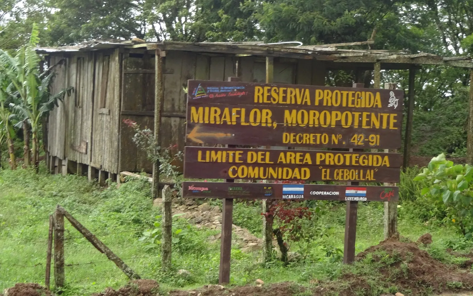
Location photograph: Miraflor-Moropotente protected-area boundary at El Cebollal, by Tisey, via Wikimedia Commons, CC BY-SA 4.0. Cropped for layout.(Wikimedia Commons: Miraflor)

Where it is
Miraflor-Moropotente lies northeast of Estelí in north-central Nicaragua. It covers roughly 287 square kilometres and protects a highland mosaic of cloud forest, oak-pine forest, tropical dry forest, headwaters, farms, and rural communities.(MARENA Miraflor overview; Protected Planet)
What makes it special
Miraflor is not a single block of untouched forest. It is a lived-in protected landscape where conservation and daily rural life overlap. Coffee, livestock, crops, family homes, forest fragments, streams, and cool upper-elevation vegetation all share the same wider landscape.
That human and ecological mix is the reason to visit. A family can pair forest walks and birding with farm life, waterfalls, horseback riding, and conversations with local guides. MARENA identifies several forest types and important water sources in the protected area. It has also recorded birds such as bellbirds and toucans on guided interpretive outings.(MARENA Miraflor overview; MARENA Estelí interpretive tour) These are examples from documented visits, not guaranteed sightings.
Where to stay nearby
Finca Neblina del Bosque describes itself as a cloud-forest accommodation within Miraflor, around 27 kilometres northeast of Estelí.(Finca Neblina del Bosque) Its cabin layouts include family-friendly options, and its official site offers guided walks, birding, and horseback experiences.
The property recommends high-clearance or four-wheel-drive access because of rural roads and trails. Families should confirm the current road, transfer, meals, guide availability, and bus information directly with the lodge, especially during wet weather.
Who it suits: families who enjoy simple rural stays, guided exploration, farm context, and a slower pace. It is a better match for curious walkers than for travelers expecting a polished resort or paved access.
5. Volcán Maderas cloud forest on Ometepe Island
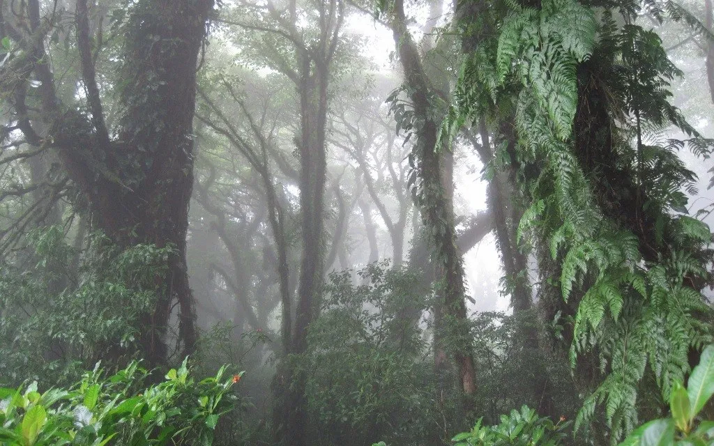
Location photograph: cloud forest on Volcán Maderas, by Martin Kulldorff, via Wikimedia Commons, CC BY-SA 4.0. Cropped for layout.(Wikimedia Commons: Volcán Maderas)

Where it is
Volcán Maderas forms the forested southeastern side of Ometepe Island in Lake Nicaragua. UNESCO places the island in a biosphere reserve shaped by dormant Maderas, active Concepción, wetlands, farms, towns, and forest.(UNESCO Ometepe profile) Maderas rises to 1,394 metres and contains a small crater lagoon near its summit.
What makes it special
The mountain changes with elevation. Research describes dry, humid, wet, cloud, and elfin forest zones rather than one uniform rainforest from shore to summit.(Volcán Maderas epiphyte study) The wetter upper slopes support abundant epiphytes and mist-soaked forest. UNESCO identifies Ometepe’s fog forests as being of particularly high conservation value.(UNESCO Ometepe profile)
Maderas is also a confirmed Key Biodiversity Area. It holds the entire known population of the critically endangered salamander Bolitoglossa insularis.(Maderas Key Biodiversity Area) Howler monkeys, white-faced capuchins, yellow-naped parrots, bellbirds, and high-elevation hummingbirds are associated with the wider mountain landscape.(UNESCO Ometepe profile; Fauna & Flora Maderas report) Their presence is a reason to protect the habitat, not a promise that hikers will find them.
Where to stay nearby
Selvista Guesthouses in Balgüe is a useful foothills base near the Finca Magdalena access. Its official directions place it close to the trailhead while making clear that the property is not up the Finca Magdalena road or inside the national park.(Selvista Maderas hiking guide)
The full Maderas summit is not a casual family walk. Current local guidance describes a guided outing of roughly six to eight hours through rugged terrain that is often wet, muddy, and slippery.(Selvista Maderas hiking guide; Fauna & Flora Maderas report; El Pital Maderas hiking guide) Families can still enjoy the lower forest, farm landscape, birds, and shorter outings without climbing to the crater.
Who it suits: nature-loving families at lower elevations. The summit should be reserved for fit, sure-footed older children or teens and adults who have a guide, proper footwear, enough time, and the willingness to turn back when conditions deteriorate.
Animals that live in Nicaragua’s rainforest landscapes
Nicaragua’s humid Caribbean forests and cloud-forest refuges support remarkable wildlife, but visibility is another matter. Many large mammals are nocturnal, wide-ranging, naturally scarce, or sensitive to disturbance. Some of the strongest records come from camera traps, tracks, calls, and targeted biological surveys rather than casual daytime encounters.
| Animal group | Examples connected to these landscapes | What families should realistically expect |
|---|---|---|
| Monkeys | Mantled howler monkeys and white-faced capuchins occur in several forested regions, including Mombacho and Maderas.(Mombacho reserve management plan; Fauna & Flora Maderas report) | Calls may carry through the forest, but sightings vary by season, route, and time of day. |
| Forest birds | Keel-billed toucans, resplendent quetzals, great curassows, great green macaws, bellbirds, and parrots are documented in different regions.(MARENA quetzal report; UNESCO Río San Juan profile; MARENA camera-trap report) (MARENA Miraflor overview) | A skilled local guide improves the chance of identifying calls and distant movement. No single site contains every bird listed here. |
| Frogs and salamanders | Red-eyed tree frogs, the Mombacho salamander, and the Maderas salamander represent the importance of humid microhabitats.(Mombacho reserve management plan; Maderas Key Biodiversity Area) | Many are small, nocturnal, highly localized, or difficult to detect. Never handle wildlife. |
| Peccaries and agoutis | Camera traps and field signs document white-lipped peccaries and Central American agoutis in Indio Maíz and Peñas Blancas.(MARENA Jinotega monitoring; MARENA camera-trap report) | Tracks or camera-trap records are more likely than a clear family sighting. |
| Wild cats | Jaguars, pumas, and ocelots use connected forest landscapes. Jaguars need large areas of intact habitat and are famously elusive.(MARENA camera-trap report; Convention on Biological Diversity; IUCN Jaguar Specialist Group) | Treat their presence as a conservation story, not a tourism promise. A sighting is exceptionally unlikely. |
| Baird’s tapir | Nicaragua’s Caribbean forests contain important tapir habitat, with evidence from tracks and camera traps.(Convention on Biological Diversity; Tapir Conservation study) | Tapirs should never be advertised as an expected encounter. Their presence signals the value of large, connected forest. |
| Harpy eagle | The species is associated with extensive, relatively undisturbed Caribbean forest and very tall rainforest trees.(Smithsonian rainforest layers guide; Convention on Biological Diversity) | It is a rare conservation-significant bird, not a likely sighting from a standard trail or lodge. |
How to choose the right rainforest experience for your family
Choose by access, not only by scenery. Mombacho is the easiest cloud-forest option for a family already in Granada. Miraflor adds slower rural travel and working-landscape culture. Maderas offers a reachable island base, but its summit is demanding. Peñas Blancas and Indio Maíz require the most patience with transport and changing conditions.
Book the guide and transport before the day. Road, boat, trail, and reserve arrangements can change with rain, maintenance, water level, and local rules. The lodge or official operator is the best source for current pickup, meals, age guidance, fees, and trail status.
Scale the outing to the youngest traveler. A short cloud-forest walk can be more memorable than pushing for a summit or remote core. Build in time for rain, snack breaks, wildlife observation, and a slower pace on roots, mud, and steep ground.
Pack for moisture and mud. Closed footwear with grip, light rain protection, refillable water bottles, insect protection, and dry bags for electronics are more useful than a rigid sightseeing schedule. Families traveling by boat should also ask the operator about properly sized life jackets.
Respect people as part of the landscape. Bosawás, Río San Juan, and Miraflor include Indigenous territories, farms, villages, and community livelihoods. Use local guides, follow access rules, ask before photographing people, stay on approved trails, and avoid language that erases the communities who live within these conservation landscapes.(UNESCO Bosawás profile; UNESCO Río San Juan profile; MARENA Miraflor overview)
Why these forests matter
Nicaragua’s rainforests and cloud forests store water, connect wildlife habitat, protect steep soils, and shelter species found nowhere else. Their future also depends on people. Forest loss, illegal ranching, land trafficking, fragmentation, fire, and climate pressure continue to affect parts of these landscapes.(Wildlife Conservation Society; peer-reviewed Indio Maíz study; MARENA Miraflor overview)
Responsible travel cannot solve those problems by itself. It can, however, support local guides, small accommodations, restoration projects, and conservation-based livelihoods when families choose carefully and follow community and reserve rules.
Frequently asked questions
Does Nicaragua have tropical rainforest?
Yes. Nicaragua contains extensive humid tropical forest, especially on the Caribbean side, as well as river wetlands, mangroves, and high-elevation cloud forest. Bosawás and Indio Maíz are the best-known large humid-forest landscapes, while Mombacho and upper Volcán Maderas offer cloud-forest experiences.(UNESCO Bosawás profile; UNESCO Río San Juan profile; Mombacho reserve management plan) (UNESCO Ometepe profile)
Which Nicaragua rainforest is easiest to visit with children?
For families based in Granada, Mombacho is the most straightforward choice in this guide. It can be structured as a day trip with vehicle access toward the upper trail network and a shorter crater route. Conditions and access arrangements still need confirmation.(Mombacho reserve management plan; Mombacho Lodge trail guide)
Can families visit Bosawás Biosphere Reserve?
Families can visit the broader Bosawás landscape, but the remote core should not be treated as a simple independent outing. Peñas Blancas and Reserva Los Nogales provide a more realistic cloud-forest gateway in Jinotega.(MARENA Jinotega monitoring; Reserva Los Nogales)
Is Guácimo Lodge inside Indio Maíz Biological Reserve?
No. The lodge’s own information places it in the biosphere reserve buffer zone near Indio Maíz, with connected forest and river access. It is a useful edge base, not accommodation inside the biological reserve.(Guácimo Lodge access guide; Guácimo buffer-zone project)
Can children hike Volcán Maderas?
Families can enjoy the Maderas foothills and shorter local outings, but the full summit is a long, steep, muddy hike. It is best limited to fit, experienced older children or teens with a local guide and appropriate equipment.(Selvista Maderas hiking guide; Fauna & Flora Maderas report)
Will we see a jaguar, tapir, or harpy eagle?
Probably not. These species are important indicators of intact forest, but they are rare, elusive, wide-ranging, or difficult to detect. Their inclusion in this guide explains the conservation value of Nicaragua’s forests, not the probability of a visitor encounter.(Convention on Biological Diversity; IUCN Jaguar Specialist Group; Tapir Conservation study)
Photography and illustration note
Every location photograph in this draft comes from the actual place or protected landscape discussed, based on its Wikimedia Commons file record. Each image has a reuse license that permits publication with attribution and change disclosure. The rainforest-layers diagram is an original illustration created for Our Life Adventures and is presented as an educational habitat guide, not a literal wildlife census.
Sources and further reading
The factual claims, access guidance, conservation context, and reusable photography in this guide are linked directly where they are discussed. This directory collects those sources in one place for readers who want to explore them in greater depth.
Protected areas, conservation and access
Rainforest ecology and wildlife
| Topic | Linked source |
|---|---|
| Smithsonian rainforest layers guide | Rainforest Layers, Smithsonian Tropical Research Institute |
| Smithsonian canopy guide | Canopy, Smithsonian Tropical Research Institute |
| Smithsonian understory guide | Understory, Smithsonian Tropical Research Institute |
| Smithsonian forest-floor guide | Forest Floor, Smithsonian Tropical Research Institute |
| Convention on Biological Diversity | Nicaragua Country Profile, Convention on Biological Diversity |
| IUCN Jaguar Specialist Group | Jaguar species account, IUCN Species Survival Commission Cat Specialist Group |
| Tapir Conservation study | A New Record of Baird’s Tapir in Nicaragua and Potential Implications, Tapir Conservation |
Location photography and licensing
| Topic | Linked source |
|---|---|
| Wikimedia Commons: Peñas Blancas | Peñas Blancas, Bosawás Biosphere Reserve, photograph by Rebecca Ore, CC BY-SA 3.0, Wikimedia Commons |
| Wikimedia Commons: Indio Maíz | Bactris palm in Indio Maíz Reserve, photograph by Dick Culbert, CC BY 2.0, Wikimedia Commons |
| Wikimedia Commons: Mombacho | Mombacho Volcano, photograph by KEITH, CC BY-SA 3.0, Wikimedia Commons |
| Wikimedia Commons: Miraflor | Miraflor-Moropotente protected-area boundary, photograph by Tisey, CC BY-SA 4.0, Wikimedia Commons |
| Wikimedia Commons: Volcán Maderas | Cloud forest on Volcán Maderas, photograph by Martin Kulldorff, CC BY-SA 4.0, Wikimedia Commons |